


Our current projection:
- 10-11 named storms
- 4-5 hurricanes
- 1-2 major
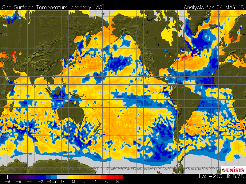
A below average hurricane season is expected across the Atlantic Ocean this year with the combination of warming in the Equatorial Pacific and cooling in the Main Development Region of the Atlantic Ocean. The latest sea surface temperature anomaly map shows a pronounced area of cooler than normal sea surface temperature anomalies in the Main Development Region. This will lead to an increased amount of vertical shear over the region making it difficult for storm development. Another factor we take into account is the sea surface temperature anomalies in the Gulf of Guinea, which shows an area of warmer temperatures. This tends to support a weaker West Africa monsoon season resulting in a lot of dry air to impact the Atlantic.
Analog years being used, match up well with the recent ENSO episode in the Pacific Ocean. A few of the favored analogs being used support a below-average hurricane season with lack of development in the Main Development Region. The most active season was 2002 with 12 named storms, but only 4 became hurricanes. The only season to feature above-average hurricane status was the 1989 season. In addition to supporting the ENSO trends, these analog years also have similar sea surface temperature anomalies that match up well with recent observations.
- 2009: 9 named storms, 3 hurricanes, 2 major
- 2002: 12 named storms, 4 hurricanes, 2 major
- 1986: 6 named storms, 4 hurricanes, 0 major
- 1989: 11 named storms, 7 hurricanes, 2 major
Combining current sea surface temperature anomaly analysis along with the analog years the areas with the greatest risk of tropical impacts will be along the Western portion of the Gulf of Mexico and the Carolinas.