


The 2018 Hurricane season featured several landfalling systems with Hurricane Florence making landfall in Wrightsville Beach, NC as a strong hurricane. Hurricane Michael made landfall as a category 5 hurricane between Mexico Beach, FL and Tyndall Air Force Base in Panama City, FL. This hurricane season featured ENSO neutral conditions. We expect +ENSO this season which will favor a less active hurricane season.
Source: WikiProject Tropical cyclones/tracksHurricane season begins June 1st but we have already seen the naming of our first system. The subtropical storm Andre developed south of Bermuda and quickly weakened. We expect a fairly normal tropical season with perhaps a slight edge towards below normal numbers given the current and expected conditions.
A review of the Sea Surface Temperatures shows us a few key factors that may inhibit long-lived and strong hurricanes this year. We are still seeing +ENSO conditions, which favor stronger vertical shear over the Atlantic Basin. This prevents storms from becoming vertically stacked leading to a tough time for disturbances strengthening into tropical storms and hurricanes. The warming can be seen over the Western Basins and extending eastward. The current conditions and future forecast for ENSO show a slow decline in +ENSO conditions. As a result, we expect this to be an inhibiting factor for development.
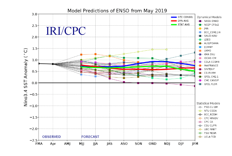
Source: IRI/CPC
With not much change expected throughout the season, we will favor slightly below average numbers for hurricanes and major hurricanes. Named systems are expected to be near normal. The areas at an elevated risk for a landfalling tropical system will be across the Eastern Gulf of Mexico into the Southeastern US. North of North Carolina and west of Mississippi we expect normal risk.
Historical averages for named storms is 12 with our forecast calling for 11. The historical average of hurricanes is 6 with our forecast calling for 5. And the historical average for major hurricanes is 3 with our forecast calling for 1. With the expectation of an unfavorable Cape Verde season we will keep the numbers slightly below average, but depending on the conditions in late July will determine if we need to revise these numbers up or down.
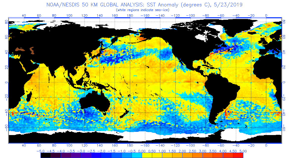
Source: NOAA
The conditions across the Indian Ocean also point towards a +IOD which further favors the continuation of +ENSO conditions and may also begin to take away from tropical activity coming off Africa. Further support of this can be seen over the Gulf of Guinea which also will favor a decrease in organized wave activity.
| Named Storms | Hurricanes | Major Hurricanes | |
| TrueWx Forecast | 11 | 5 | 1 |
| Historical Average | 12 | 6 | 3 |
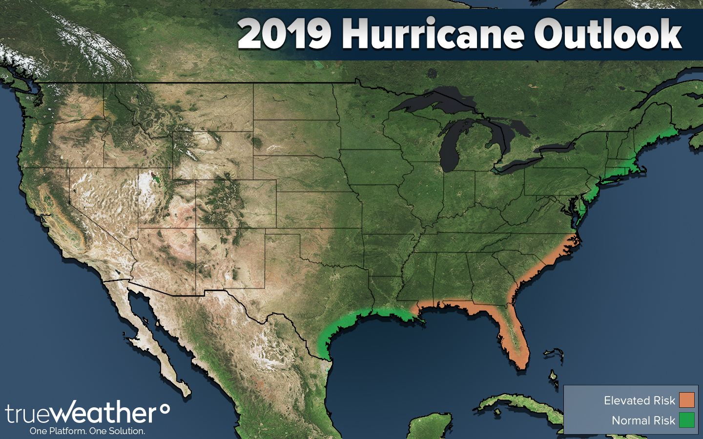
trueWeather 2019 Hurricane Projection